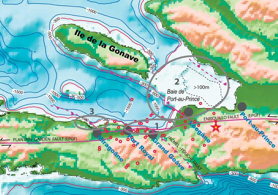
Only a seismologist could fully understand the implications of something that took place in Haiti on January 12: a tsunami hit Petit Paradis, a coastal village north of Port-au-Prince, shortly after the earthquake. This signaled that another fault line, one distinct from the Enriquillo Fault whose slippage caused the quake, might have shifted during a series of aftershocks. Scientists had never detected a fault in this area, and now they were anxious to see if one existed. They also wanted to assess if this potential fault line, or Enriquillo, would slip again.
Within days, seismologists and marine geologists from Columbia were organizing a monthlong research trip aboard The Endeavor, a ship owned by the National Science Foundation, with scientists from several other institutions. They are traversing Haiti’s coast through March, using sonar equipment to scan the ocean floor for recently formed cliffs, hills, or gas pockets — anything to indicate where the earth moved and may move again.
“It’s important to do this work now, because we need to characterize what happened on the seafloor before storms and waves wipe out the evidence,” says chief scientist Cecilia McHugh, a Columbia marine geologist. “Figuring out how this earthquake worked and where other earthquakes may be prone to occur is critical for a lot of things, including where to resettle people, where to build houses, and how strong to build them.”