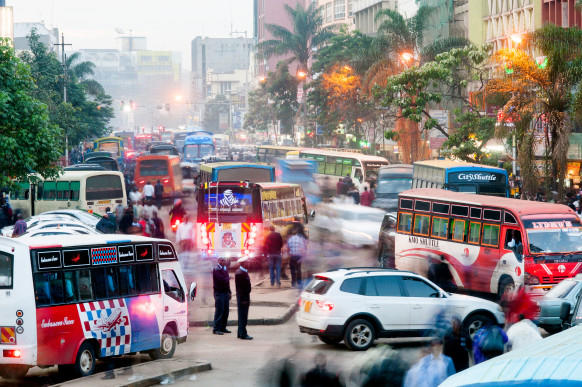
Using the GPS technology found in most smartphones, an international team of researchers led by Columbia’s Jacqueline Klopp has created the first map of Nairobi’s main transit system — an informal network of privately owned buses that can be bewildering to navigate, even for longtime residents.
“Until now, getting from point A to point B in Nairobi could be an adventure,” says Klopp, a research scholar at Columbia’s Center for Sustainable Urban Development. “Most people knew where to catch buses traveling toward the destinations they were most familiar with, but if they were headed someplace new, they had to rely on word of mouth for directions.”
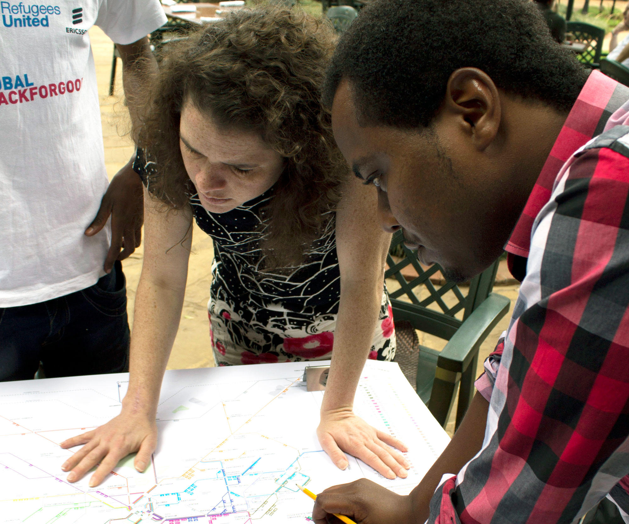
Klopp and several colleagues first decided to remedy this situation back in 2012, when they were researching land use and transportation planning in the Kenyan capital. With the help of professors at the University of Nairobi, they enlisted college students to ride around in the city’s minibuses, which are called matatus, and use their smartphones to note the locations of some three thousand stops on 135 routes. Klopp’s partners at MIT’s Civic Data Design Lab then designed a map showing all the routes. The map, which bears a resemblance to Massimo Vignelli’s iconic 1972 New York City subway map, was released last year. Klopp and her partners at the design firm Groupshot, based in Cambridge, Massachusetts, subsequently worked with Google to create an electronic version of the map.
“Local residents tell us that traveling around Nairobi is now easier and safer,” says Klopp. “Women are especially enthusiastic, as they’re less worried now about inadvertantly ending up in a dangerous neighborhood.”
Klopp hopes that the map, by providing matatu operators and urban planners a full picture of the city’s transit routes, will also inspire improvements to the system. She says there are already indications that matatu drivers are adding routes to underserved areas and that officials planning a new commuter train line are consulting the map to determine where train stations ought to be created so that riders can access matatus.
Meanwhile, Klopp and her collaborators have started talks with five more cities in Africa — Kampala, Uganda; Accra, Ghana; Lusaka, Zambia; Cairo, Egypt; and Maputo, Mozambique — to map their informal mass-transit systems.
“We see this as a social-justice issue,” Klopp says. “There is no reason why city dwellers in developing countries today should struggle to find their way to a job interview or a doctor’s appointment.”