IRI is at the forefront of a field called climate services. Can you explain what scientists in your field do?
We collaborate with farmers, public-health officials, water managers, and others to understand how climate conditions affect their work. We then help them make better decisions, based on predictions of what climate conditions will likely occur from a few weeks to several years in the future.
What types of decisions do you help people with?
Well, if farmers know there’s a good chance of a drought occurring in the next growing season, they might plant crops that don’t require a lot of rain, even if those crops are less profitable than ones they’d ideally like to plant. Or if health officials in the tropics know that the next rainy season is likely to be wetter than usual, they might make a bigger investment in malaria-prevention measures, like bed nets. It’s all about helping people use their resources wisely and in a timely manner.
How can you predict the weather so far in advance?
Unlike TV meteorologists, we don’t attempt to say what the weather is going to look like on any specific day. Rather, we offer forecasts that describe the range of total rainfall and average temperatures that a region is likely to experience in a given season. So whereas meteorologists track the movements of particular pressure systems, we study phenomena that may cause a region’s climate to differ from previous years. One of the key factors we consider is the temperature of the oceans. The warmth of water near the ocean’s surface has an enormous impact on climate, because it affects the temperature and humidity of the air above it. And since ocean currents change slowly, they are predictable weeks to months in advance. This enables us to anticipate their effects on the atmosphere. The most important example of a predictable climate phenomenon is El Niño, which occurs when waters in the eastern and central equatorial Pacific Ocean become uncharacteristically warm every few years. El Niño robustly influences weather conditions over nearly 30 percent of all land on Earth, all the way from the western coasts of North and South America to the Horn of Africa and India.
Didn’t Columbia researchers play a key role in discovering El Niño’s global effects?
Yes, Mark Cane, a Columbia climate scientist, was the first one to predict changes in El Niño’s sea-surface temperatures, using a forecasting model that he and Steve Zebiak, his student at the time, created in the mid-1980s.
You could say that their work essentially gave birth to the field of climate prediction, which led to the new endeavor of climate services. While there are many ocean phenomena that influence our planet’s climate, El Niño is the most powerful in influencing annual variations. Over the years, we’ve gotten better and better at predicting El Niño and its effects.
When was IRI founded?
The US government, through its National Oceanic and Atmospheric Administration, awarded Columbia a major grant to create IRI in the mid-1990s, with the aim of sharing our knowledge of seasonal climate variability and forecasting with the rest of the world. Mark and Steve’s presence here was a huge factor, as was the fact that Columbia is home to many other top climate scientists. We now have a staff of nearly fifty researchers, and we are the world’s preeminent research group dedicated to creating seasonal forecasts and translating our results into actionable information.
Where do your scientists work?
We have ongoing collaborations in dozens of countries. In some, we’re working with government ministries to develop their forecasting systems from scratch. In others, we’re working behind the scenes, providing technical support to local scientists who are seeking to improve their forecasting systems. A big part of what we do is sharing our forecasting technology and decision-making methods with other scientific groups.
We also work with aid organizations. The International Federation of Red Cross and Red Crescent Societies, for instance, uses our forecasts to anticipate what parts of the world are most likely to be hit by floods, droughts, and other types of severe weather several months in advance. This enables them to mobilize relief workers ahead of time and respond to emergencies faster and more cost-effectively.
So you are predicting specific weather events.
Not exactly. Not in the sense of saying, “A hurricane is going to hit Jamaica six weeks from now.” But sometimes, in addition to projecting the total rainfall that a region may receive in a given season, we can also predict whether that rain will fall nice and evenly over the course of the season or arrive in a few big bursts. In some cases, we may also be able to say something about the frequency of intense heat waves. This can be just as helpful to know. It can tell farmers the risk that certain types of crops may get washed away or dried out, and if aid agencies should be prepared for the possibility that thousands of people may get displaced by floods or droughts.
One of the places you’ve done extensive work is Uruguay.
Yes, our scientists have collaborated with the Uruguayan government to build a forecasting system for farmers that is the most advanced of its kind. Today, a farmer in Uruguay can log onto a website that we helped to create and learn what kind of climate conditions are likely to materialize in his specific county. A typical forecast might state: your area has a 50 percent chance of receiving less rain than usual, a 30 percent chance of receiving an average amount, and a 20 percent chance of receiving more rain than usual. He can then use the website to find out how much money he’s likely to earn by planting various crops — say, corn, wheat, barley, or sorghum — under each of those climate scenarios. He can also find out the potential benefits of fertilizing or irrigating. The tool is individualized, sophisticated, and extremely easy to use.
Uruguayan government officials are also using the forecasts to decide where droughts may necessitate the distribution of emergency assistance.
Despite having an agricultural economy, Uruguay is a fairly prosperous country. Don’t you typically work in poorer ones?
Most of our work is focused on helping developing nations. One of the reasons we took on the project in Uruguay is because its agriculture ministry is extremely well run and the country has a vibrant scientific community. This helped us to create a top-notch forecasting system. And our goal was always to create a system that could serve as a sustainable model for other countries.
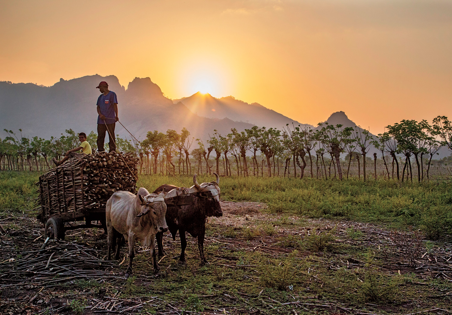
Developing countries need our help because they’re especially vulnerable to climate variability. Nearly 80 percent of the world’s farmers still depend primarily on rainfall, rather than irrigation, for watering their crops. That means that if little rain comes, they’re completely out of luck. They might not be able to afford to send their children to school, to pay back a loan they’ve taken to buy fertilizer, or to feed their family.
The University recently announced that it will work with your team to replicate and expand this effort in several other countries.
Right. This will be part of an initiative called Columbia World Projects, which President Bollinger launched earlier this year to promote academic endeavors that address pressing global problems. We’re going to be joining forces with faculty from across the University on this, as well as longtime partners in international organizations. We’re still in the process of selecting five to six host countries. But our efforts in each country will aim to accomplish four goals related to agriculture: improving food security, nutrition, and economic livelihoods, and supporting environmental stability.
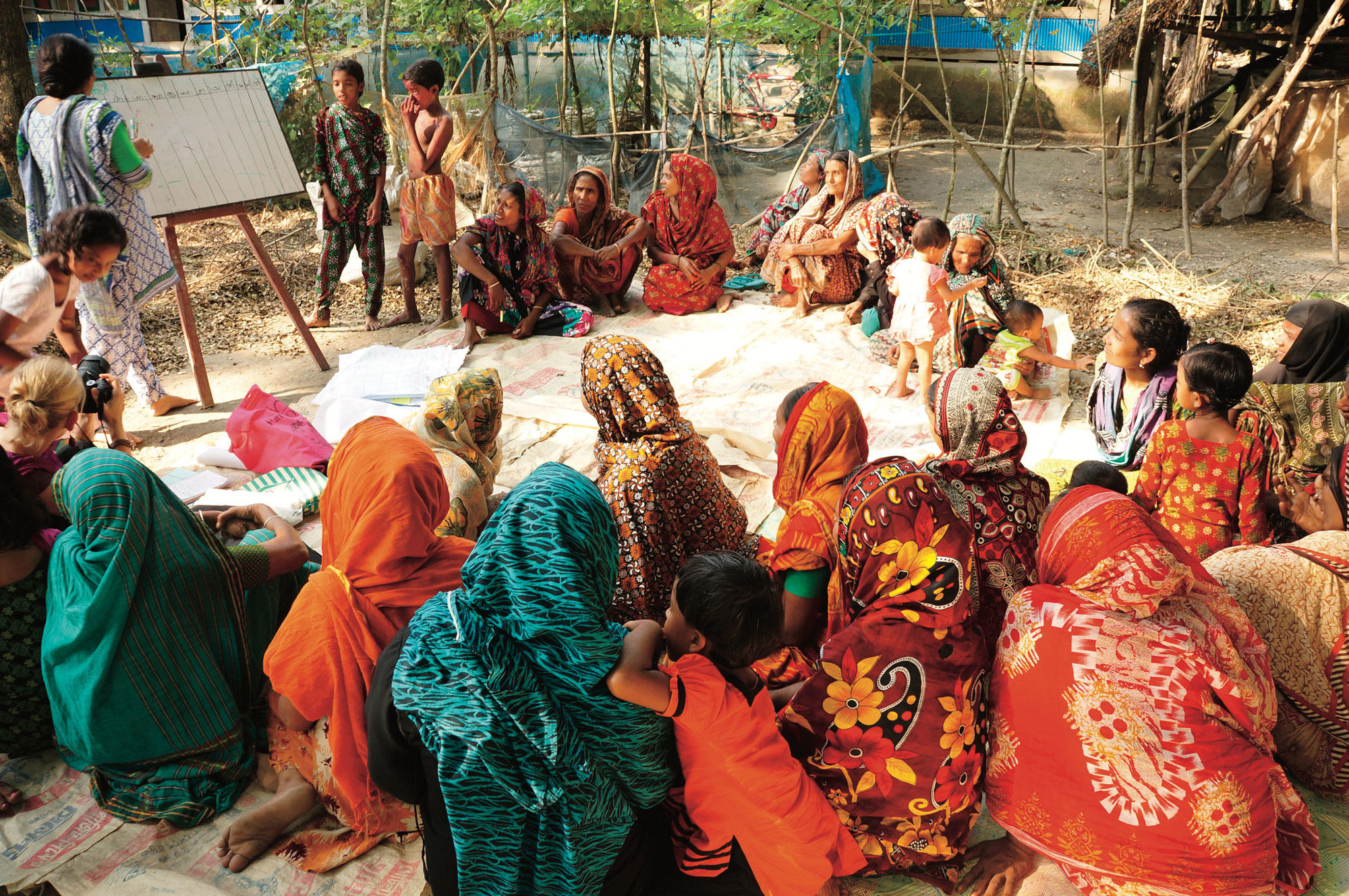
IRI also has quite a few ongoing projects in Africa, in countries that include Ethiopia, Ghana, Kenya, Mali, Rwanda, Tanzania, and Zambia. What does your work in these countries look like?
Helping farmers is a major focus of our work in Africa, too. In addition to providing farmers with climate forecasts, we’ve developed a new type of agricultural insurance, called index insurance, that issues payouts to farmers in years when the weather is especially bad. This is different from traditional insurance. Traditional insurance policies pay people in accordance with the losses that they personally experience. But that kind of insurance is prohibitively expensive to administer in some developing countries. That’s because in order to verify losses, insurance adjusters would have to visit every single farm, and they’d be inspecting huge numbers of small farms spread out over vast distances. But if payouts are based on a climate outcome, the administrative costs plummet and insurers are able to sell policies for less. We’ve conducted studies demonstrating the effectiveness of this approach in several African nations. As a result of our work, millions of farmers on the continent now have access to insurance for the first time.
They’re benefiting in some surprising ways. It’s not just a matter of covering their losses in bad years. Insurance can also give farmers the security they need to fully capitalize on good weather. We’ve found that poor farmers who are insured are much more likely to respond to favorable climate forecasts by taking calculated risks that enable them to get out of debt, and even see profits. This might mean getting small loans to purchase fertilizer, high-yield seeds, or additional livestock. We’ve shown that if farmers capitalize on a few good seasons in this way, they can often lift themselves out of poverty.
Is there a certain level of education people need to use your forecasts?
We find that people of all backgrounds are accustomed to dealing with fairly complex choices in their work and that, with a little training, they’re usually able to make use of the information we provide. Farmers in developing countries have to be pretty savvy in order to survive.
IRI scientists are not typically working directly with individual farmers, though. We often provide training to local agriculture officials or humanitarian-aid workers who then translate the forecasts to farmers in ways that make sense to them. In this way, we can help the largest number of people.
But even working with these intermediaries, we face challenges. In some of the places where we’ve worked, the local language has no word for the concept of “probability.” Once, in a meeting in Kenya, a colleague of mine communicated the concept to local aid workers using a paper airplane, which he flew repeatedly, marking all the spots where it landed on the floor to represent the range of possible climate outcomes. The locals got it, and their communities have since embraced our forecasts.
Do farmers in the United States rely on seasonal climate forecasts?
Not as much as you might think. The National Weather Service generates some seasonal forecasts, but the agency honestly doesn’t have a lot of traction with American farmers. This is partly because major agribusinesses here in the US, as well as in other wealthy countries, have such elaborate irrigation systems and insurance subsidies that they’re somewhat insulated from the variability of climate.
Do you see international support for this kind of work gaining momentum?
Oh, absolutely. Global warming is a driving force behind it. Outside the United States, where discussion about climate change has not been warped by politics, there is little debate about whether global warming is real. Everybody sees it’s real. Farmers can see the effects it’s having. They know that they’re experiencing increasing temperatures and thus more severe droughts, and more powerful storms than their parents and grandparents saw. And city dwellers recognize that they’re becoming more vulnerable to floods and water shortages and deadly heat waves. Just in the last few years, we’ve seen more and more countries willing to invest in climate forecasting systems, as the need to adapt to climate change takes on greater urgency.
What are the challenges of your work moving forward?
You’d think that in an age when weather satellites are continuously orbiting the earth we’d have all the data we need to produce climate forecasts for the entire planet, but that’s not the case. The problem is that in order to produce forecasts that are truly useful to people — that is, those that indicate how an upcoming season’s climate may compare to what people in the region are accustomed to — you also need historical climate data. This typically consists of many years of rain-gauge and temperature-sensor readings that have been digitized and uploaded into global databases. But in some developing countries, this data is incomplete or hasn’t been digitized yet. One of our big initiatives now is to work with African countries to fill in the gaps in their historical records so that we can generate better forecasts for them. In the future, we hope to provide the entire continent with monitoring and forecasts as detailed as those now available in Uruguay.