Sea levels are expected to rise one to three feet this century, mainly as a result of melting ice at the earth’s poles. This threatens all coastal communities, and New York City is especially at risk: It has 578 miles of coastline among its five boroughs and many roads, railways, and airport runways are at sea level or below. To make matters worse, shifting weather patterns are expected to increase precipitation by 8 to 10 percent in New York City by 2080 and hurricanes are expected to intensify.
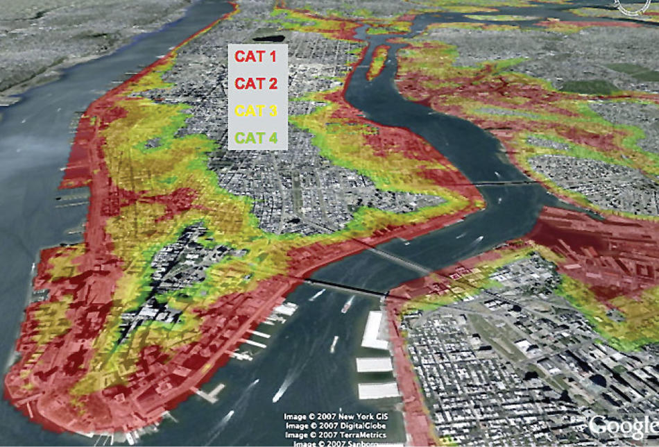
Columbia scientists are helping city and state officials figure out how to prepare. Seismologist Klaus Jacob, who is an expert on coastal flooding, is creating a 3-D map of the city’s subway system to identify those stations that will become more susceptible to storm surges. His research shows that at the end of this century, because of higher sea levels, storm surges that today would be considered 100-year floods could occur every 10 years. The city, he believes, should consider building floodgates and berms now. “Katrina was a preview of what is coming in many other places,” he says.
Some professors are working with the state Department of Environmental Protection to determine how storm-drainage and water-treatment systems will be affected. New York City, like many municipalities, has a combined drainage and sewer system, meaning that untreated sewage mixes with rain runoff during even minor floods. “We’re using geographic information systems to understand the vulnerability of every neighborhood,” says Cynthia Rosenzweig, a Columbia climate scientist.
Over the next two years, Columbia policy experts and climate scientists also will bring local environmental organizations together to discuss the feasibility of various adaptation strategies, from erecting flood barriers to limiting construction in low-lying areas to planting gardens atop roofs as a way to reduce water runoff. Supported by a $500,000 grant from the HSBC Foundation, the project will send Columbia graduate students to consult for the environmental groups.
“Columbia experts won’t enter this discussion with our minds made up about what is the right approach,” says Steve Cohen, who is executive director of Columbia’s Earth Institute and will lead the outreach effort. “We’re going to facilitate a discussion and go with the consensus that emerges. At the end of the project, the participants should have some hard-and-fast suggestions for the city.”