The storm made landfall. The Hudson rose and rose. Klaus Jacob went to bed.
“I knew what was going to happen,” he says with a shrug in his voice.
Of course he did.
On the evening of October 29, Superstorm Sandy, a weather event so gigantic and freakish that the word “hurricane” was insufficient, whipped the New York area, which lay to the right of that gargantuan white spiral in the satellite picture, the windier side. The Atlantic, plowed by winds, piled up high and rushed toward the coastline.
At around 9:00 p.m., New York harbor was a churning, brimming tub. Waves heaved and crashed. One wave measured thirty-two feet.
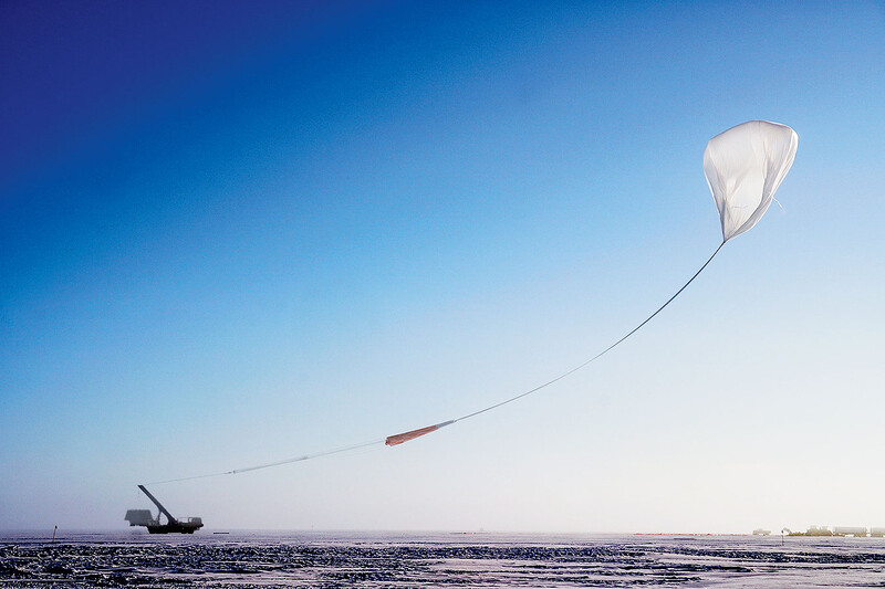
At 9:24, a storm surge of 13.88 feet, breaking the record of 10.2 feet set by Hurricane Donna in 1960, breached the seawalls of Lower Manhattan, flooding subway tunnels and knocking out power. Twelve miles north of the city, up the wooded banks of the Hudson River, on a swollen tributary in Piermont, New York, behind a stand of marsh grass, in an old Dutch settlement, inside a white clapboard house, Jacob, a seismologist at Columbia’s Lamont-Doherty Earth Observatory, climbed the steep wooden staircase.
The Awakening
Sea level rise will eventually inundate low-lying areas permanently if no mitigation or adaptation measures are taken, and may also accelerate saltwater intrusion in some areas.
So it had come, the Big One that Jacob and his colleagues had imagined when they produced the now-famous 2011 report Responding to Climate Change in New York State, known as the ClimAID study. Chapter 9, written by Jacob and civil-engineering professor George Deodatis ’87SEAS, focused on transportation, and what the city could expect from a hundred-year storm — what the authors likened to “a non-direct but nearby hit of a category 1 or category 2 hurricane.”
For most transportation facilities, the increased coastal storm surge hazard will dominate over these permanent inundation hazards for most of this century.
The state-funded study was led by Cynthia Rosenzweig, a senior research scientist at the NASA Goddard Institute for Space Studies at Columbia; William Solecki ’84CC, director of the CUNY Institute for Sustainable Cities; and Art DeGaetano of Cornell.
If existing infrastructure is not upgraded and adapted to the new demands posed by climate change, it will put the neglected regions, their economies, and, in the worst cases, lives in jeopardy.
Jacob awoke at dawn. The winds that had rocked him to sleep still rattled the dark house. The night before, Jacob had shut off the circuit breakers and disconnected the gas. Now he smelled the usual ocean smell that comes with living by a tidal river, only maybe it was nearer than usual. He knew, lying there, that the water had entered during the night, risen, and receded with the tide.

He knew, too, that the press would want to talk to him about all the things he knew. In September, the New York Times had published an article by Mireya Navarro ’04JRN titled “New York Is Lagging as Seas and Risks Rise, Critics Warn.” In the article, Jacob, noting how the storm surge of Hurricane Irene a year before had come within one foot of flooding New York subway tunnels and highways and knocking out power to commuter rail lines, said, “We’ve been extremely lucky. I’m disappointed that the political process hasn’t recognized that we’re playing Russian roulette.”
That quote got picked up as Sandy approached.
Now they’d be calling him “prescient.” They’d get mileage out of that word. New York magazine would ask, “Is Dr. Klaus H. Jacob the Cassandra of New York City Subway Flooding?” A rhetorical question, presumably. Still, any of the study’s authors would say that it was a straightforward analysis that hardly required powers of prophecy.
Jacob, white-bearded and nimble, got out of bed and went down the stairs to deal with the inevitable.
The Aftermath
The storm left some two hundred people dead, with at least forty-three deaths in New York City. In New York State, Sandy damaged or destroyed 305,000 homes and 265,000 businesses. Millions of people lost power. In Manhattan, outages caused misery for thousands of residents of public-housing high-rises. The subway flooded. A major hospital failed, prompting the heroic evacuation of hundreds of patients in seventy-mile-an-hour winds, while lab mice drowned and years of medical research was destroyed.
Columbia’s campuses escaped damage, and faculty and students mobilized for an aftermath filled with endless opportunities for assistance and study. The Mailman School of Public Health organized a relief effort in the Rockaways. Journalism students covered Sandy stories in print and video. And researchers at Lamont- Doherty, the Earth Institute, and the Fu Foundation School of Engineering and Applied Science continued to collaborate to produce climate-research data for decision makers, residents, farmers, businesspeople, and urban planners.
At the political level, Governor Andrew Cuomo (“Climate change is a reality, extreme weather is a reality”) and Mayor Michael Bloomberg made some of the strongest statements by any US official in acknowledging climate change as a fact. Bloomberg, in an editorial, called on elected leaders to take “immediate action.”
But what sort of action? At what cost? And where, and for whom, and on what?
Games of Risk
“Here is a critical issue of the highest importance,” says George Deodatis in his Mudd Hall office, three weeks after the storm. Deodatis speaks with a sonorous Greek accent and a measured cadence. “Hurricane Sandy: is this something that is really out of the ordinary, or something we should be expecting on a more regular basis?”
The question carries the deep echo of a riddle: we are in the dark caverns, the deep fog, of probability.
“If this is the event that happens once every thousand years, then probably the measures we have to take should be less drastic than if this were a hundred-year event,” says Deodatis, whose research areas include probabilistic mechanics, risk and reliability, and hazards analysis. “Design codes are based on the hundred-year or five-hundred-year event, not the seven-hundred-year or thousand-year event. The idea of a seven-hundred-year return” — a figure offered by some scientists — “is based on the climate having been pretty much stationary over the past two thousand years or so. However. In my opinion, and in others’ opinion, something is changing in the climate.”
His “something is changing” has a wistful note of wonder, of well-fed suspicion, like a scientist with a finger on his chin.
“This is now most probably not going to be the seven-hundred-year event,” Deodatis says, “but one we will be experiencing at much shorter intervals. And we have to do something about it.”
The Urgency of Now
Here’s what Deodatis sees as our options for defending New York City against future floods.
In the short term — measures that could be implemented within two years — we could build floodgates at entrances to tunnels and subway stations, cover ventilation grates, and build seawalls or dikes in front of vulnerable communities. “That would be a small investment,” Deodatis says, “and the least controversial.”
For the medium term — within two decades — we could raise infrastructure (“a raised highway will create a nice levee”) and construct barriers to New York harbor at three locations: the Verrazano- Narrows Bridge, the Arthur Kill between Staten Island and New Jersey, and where the East River meets the Long Island Sound. Deodatis calls that “a major investment,” adding that “spending $20 billion or more to protect a relatively small percentage of the population is something that will have to be debated.”
The long-term option, which would take more than fifty years, is, to Deodatis, the most contentious and costly: moving entire communities farther inland — what the climatologists call “planned retreat.”
“But all measures,” says Deodatis, “should be considered from a cost-benefit point of view.”
They should also be considered quickly.
“My opinion is, if no decision is made within a year, then nothing will happen,” Deodatis says. “This is the experience gained from past natural disasters: immediately after, there’s a lot of talk about doing something. But then people start saying, ‘OK, let’s postpone it,’ then something else more important comes in, and people’s attention is diverted.”
Tremors
At 2:07 p.m. on August 10, 1884, an earthquake struck off Coney Island. The shocks toppled chimneys in New York and New Jersey, knocked dishes off shelves, swayed chandeliers in Midtown hotels. Seismologists place that pre–Richter scale event at a 5.5.
In the early 1990s, Klaus Jacob, more conversant than most in the fault lines beneath New York City and near the Indian Point nuclear power plant, was chair of the scientific advisory committee to the New York State Office of Emergency Management.
“I always said, ‘Look. We have to find out what happens during an earthquake,’” Jacob says. A Columbia-led group of investigators persuaded FEMA to fund a study.
“Using computer models, we placed a magnitude 5, 6, and 7 in the location of the 1884 earthquake in Brooklyn,” Jacob says. One of his coauthors was George Deodatis.

In the late 1990s, Jacob presented their results at an Earth Institute event at Columbia. The audience included some “climate people,” Jacob says, who approached him and asked if similar loss estimations could be made for climate-related events. “We don’t know,” Jacob told them, “but we can try.” Those trials were incorporated into what became Climate Change and a Global City: An Assessment of the Metropolitan East Coast Region, known as the MEC study, published in 2000. Jacob covered infrastructure, anticipating, just as he would do in the 2011 ClimAID report, the vulnerabilities exposed by a catastrophic storm surge.
In August 2001, Jacob went to Seven World Trade Center — the forty-seven-story building that would collapse hours after the fall of the Twin Towers — to share the earthquake findings with the mayor’s Office of Emergency Management.
What really impressed the audience that day, Jacob recalls, was the amount of debris that a magnitude 6 or 6.5 would produce. In that scenario, Jacob told his listeners, New York’s brownstones would crumble throughout the city. Brownstone was a poor earthquake performer.
“Then 9/11 occurred,” says Jacob, “and you couldn’t talk about earthquakes, hurricanes, or anything about natural disaster. For five years it was all terrorism. We lost ten years of preparedness for natural disasters in this country.”
The A-Word
It’s hard to catch up to Cynthia Rosenzweig. She moves fast. She’s co-chair of the New York City Panel on Climate Change, convened by Mayor Bloomberg, she develops and designs major climate-change assessments, she organizes and leads, she runs and runs. Maybe you’ve seen her on TV, in a dark-blue North Face fleece pullover, saying, in her soft voice, “We have to learn how to be more resilient, because climate change is already occurring, and is projected to continue to worsen,” a message she’s been evolving since her first peer-reviewed paper, “Potential CO2-Induced Climate Effects on North American Wheat-Producing Regions,” was published in 1985.
Today, twenty-seven years and billions of tons of carbon dioxide later, and a week after Sandy, Rosenzweig is in Philadelphia, at Drexel University, leading the second annual meeting of the Consortium for Climate Risk in the Urban Northeast (CCRUN). The consortium, one of eleven regional research units established by the National Oceanic and Atmospheric Administration to study climate risks, includes Drexel, the University of Massachusetts, Stevens Institute of Technology, and the City College of the City University of New York.
“We have this group of researchers who are already in place and have been studying these exact risks of climate extremes,” Rosenzweig says during a break. “Now we’re organizing to do the research needed to understand the problems and create the best solutions.”
Rosenzweig is joined by Robert Chen, director of the Earth Institute’s Center for International Earth Science Information Network. Chen, who studies the interaction between human and environmental systems, promptly drops the A-word.
“People are aware of the immediate event, but they may not be aware of longer-term issues of adaptation,” Chen says. “Adaptation isn’t just engineering; it’s education, it’s adoption of new building standards that take climate change into account, it’s ecologically based policy, it’s environmental justice. And since climate change is not completely predictable, you need adaptive social learning so you’re not just proposing solutions good for the next fifty years, but ones that will allow continuous flexibility.”
“We look at what we call ‘pathways to climate resilience’ in a very holistic and integrated way,” says Rosenzweig. “There are three main areas in this approach: engineering projects, like subway gates and storm barriers; the ecology; and planning and design policies for our communities. We can’t just pick one engineering solution or one ecologically based solution or one policy.”
The Elephant in the Room
The first report that Klaus Jacob and the climate people assembled was the 2000 MEC study, which looked at climate-change impact on the New York metro area. Jacob, assessing infrastructure, quickly came up against a barrier.
“The MTA, which runs the subway system, wouldn’t cooperate,” he says. “I was mostly interested in the MTA because I already had a hunch that the subway would be a problem. So we did the study as well as we could.” Luckily, they found an old FEMA study from 1995 — the Metro New York Hurricane Transportation Study, which gave the lowest critical elevation for each subway line. Somewhere, that line would flood.
“From that study we knew that we had to have the MTA’s cooperation. Where does the water go? How far? How big is the volume of the tunnel?”
In August 2007, a rainstorm caused flash flooding in the subway system, disabling or disrupting every line. The next month, the MTA set up a blue-ribbon commission on sustainability, aimed at making the MTA more ecologically friendly. The next year, the mayor’s office convened the Climate Change Adaptation Task Force, which included the MTA and all the other key transportation providers in the region.
Jacob and Rosenzweig gave talks to MTA officials about climate change, risks of damaging saltwater intrusion into the subway system, and the need for adaptive measures. The officials were ready to listen, if not to act. “They didn’t want to hear bad news,” Jacob says — that is, they didn’t want to spend more money.
In 2008, the MTA invited Jacob to sit in on a meeting of the sustainability commission, as an observer. Jacob listened as the commissioners discussed their green initiatives: reducing water consumption for washing subway trains, converting gasoline-burning buses into hybrids, putting solar panels on the roofs of above-ground stations.

When the meeting was over, Jacob raised his hand.
“This is all fine and good,” he said. “You are all very good at thinking about mitigation. You’re talking about spending tens of millions for mitigation. But you’re not talking about spending a few billion to save many billions, through adaptation.”
The commissioners, Jacob recalls, were a little baffled. For one thing, they didn’t know who Jacob was. Perhaps they were surprised when they saw him at the next meeting. Toward the end of that session, Jacob spoke up again.
“What about adaptation?” he said. “The elephant in the room!”
“Would you explain what you mean?” they said.
“Give me twenty minutes next session,” said Jacob, “and I will tell you what I mean.”
The commissioners agreed to hear him out. At the next session, Jacob took the floor.
He told the commissioners that, in the event of a hundred-year storm, the subway tunnels will flood, and that the problem will worsen as sea levels continue to rise, with losses in the tens of billions of dollars.
When he was done, the commissioners said, “We can’t make you a commissioner, but we can have you write a chapter in the blue-ribbon commission report on sustainability.”
Jacob, with help from Rosenzweig and Earth Institute research scientists Radley Horton ’07GSAS and Vivien Gornitz ’69GSAS, wrote a chapter on climate-change adaptation, with an agreement from the MTA that it would publish an online white paper explaining the study’s technical details.
“The MTA engineers were wholeheartedly on board with the risk assessment,” Jacob says. “But they had difficulty bringing it up to the board of directors, and therefore laying the groundwork for change in Albany. The MTA always struggles with not having enough money from Albany. The fares don’t cover it, and each time you spend money on something like flood protection, you can’t spend money on new trains or hybrid buses, and the public gets up in arms.”
In 2009, New York State, witnessing the city’s efforts, asked for its own climate-impact study. Rosenzweig formed a team of colleagues, and the New York State Energy Research and Development Authority provided a grant of around $1.5 million.
“NYSERDA collects money from you and me each time we pay our utility bills,” Jacob says. “A small percentage goes into a fund, and that has to be spent, and they realized it ought to be spent meaningfully, and foresightedly. So they funded this study.”
From the October 30, 2012, Statement by MTA Chairman Joseph J. Lhota
The New York City subway system is 108 years old, but it has never faced a disaster as devastating as what we experienced last night. Hurricane Sandy wreaked havoc on our entire transportation system, in every borough and county of the region. It has brought down trees, ripped out power, and inundated tunnels, rail yards, and bus depots.
As of last night, seven subway tunnels under the East River flooded. Metro-North Railroad lost power from 59th Street to Croton-Harmon on the Hudson Line and to New Haven on the New Haven Line. The Long Island Rail Road evacuated its West Side Yards and suffered flooding in one East River tunnel. The Hugh L. Carey Tunnel is flooded from end to end and the Queens Midtown Tunnel also took on water and was closed. Six bus garages were disabled by high water.
So It Was Written
“When this NYSERDA funding came through,” Jacob says, “and we had enough money and time to really focus on a detailed study, we were ready.”
That study became Chapter 9 of the 2011 ClimAID report, in which much of Sandy’s havoc on transportation was foretold.
“George Deodatis put several of his undergraduate and master’s-level students on it,” Jacob says. “We got the dimensions of the tunnels, of the surfaces of the ventilation grates in all the flood zones of New York City, square foot by square foot. With the help of those students, we crunched the data and put the right physics formula in to find out how fast the water flows through grates. We calculated forty minutes to flood the tunnels under the East River and the Harlem River.”
That was pretty much on the nose.
“The students really worked their butts off. It was twenty years of work in two years.”
Chapter 9 did help guide the MTA in its attempts to secure subway entrances and grates with plywood barricades and sandbags.
“But of course,” says Jacob, “these were Band-Aids. They somewhat reduced the impact, but Sandy was too overwhelming.”
De Watersnoodramp
In the winter of 1953, over the North Sea, a powerful windstorm drove a shelf of water toward the Netherlands at the time of highest tides. The storm surge came with little warning, at night, while many people were asleep. It breached dikes and swallowed houses. More than 1,800 people died. The Dutch called the event Watersnoodramp, meaning “flood disaster.”
“After that storm,” says Klaus Jacob, “the Dutch pulled themselves together politically and financially and rebuilt their flood-control system for a ten-thousand-year storm. They called it the Delta Project, and they worked on it for decades. Of course, keeping the ocean out is a job that never ends.
“By the 2020s, because of sea-level rise, the defense will be good for a one-in-a-thousand-year storm. By the end of the century, it will be good for a one-hundred-year storm. So they have decided to not necessarily raise the levees, except in a few places, but to harden them, so that the water can overtop the levees and dikes without eroding them. That way, the whole ocean doesn’t come in, only the water that goes over.
“They will now rezone their terrain behind the dikes and levees to build catch basins, green parks, and soccer fields to absorb the water. Behind this they will raise their cities — they are building entire city blocks practically on barges that go up and down with the tides in those catch basins. Where there is old infrastructure and old cities, like in Rotterdam and Amsterdam, they internally secure them.
“They take a very integrated approach, and I think New Amsterdam should learn from Old Amsterdam. I want a sustainable New York City, not one that’s doomed two hundred years from now.”
A Strange Turn
It was one of the most destructive natural events in recorded history. On August 26 and 27, 1883, the fuming volcanic island of Krakatoa, located between the islands of Sumatra and Java in what is now Indonesia, erupted in earnest. The explosions were heard two thousand miles away in western Australia. Shock waves circled the globe seven times. Black ash shot fifty miles into the sky. Ash and stones rained down, killing hundreds. Chunks of the shattered island collapsed under the sea, triggering tsunamis that flooded coastal villages. The Dutch colonial government blamed the tsunamis for most of the 37,000 deaths linked to Krakatoa.
The eruption also changed the weather. Sun-blocking ash caused global temperatures to cool. There were blood-red sunsets and green moons. But weather followers noticed something else in the sky: clouds of high-altitude volcanic dust moving at high speeds. The patterns indicated previously unknown wind currents in the upper atmosphere. These winds would become known as the jet stream.
Radley Horton has his eye on that ribbon of west–east wind. A normal jet stream, he says, would have blown Sandy out to sea; instead, the jet stream was weak, with steep north–south dips. That weakness allowed the storm to stagnate over land.

In an office at the NASA Goddard Institute for Space Studies, on West 112th Street, Horton, who wrote the climate chapter of the 2011 ClimAID study, describes what made Sandy extraordinary: the nearly thousand-mile diameter of the tropical-storm-force winds that “got more of the Atlantic Ocean spinning than usual, so the surge was able to pile up”; its passing over water that was up to three to five degrees warmer than average; the timing of the surge with high tide; and the interaction with another storm passing west to east.
“But the other element that’s interesting — and disturbing — is the unusual track the storm took,” Horton says. “Turning west after it was pretty far north. Normally, in late October, any storm that gets as far north as Delaware and New Jersey is generally going to get caught up in the jet stream, which by then is usually blowing strong. In this case, we had a meandering jet stream, very wavy, with a real kink in it that enabled the storm to take more of an east-to-west path.”
Horton has been investigating whether this wavier, weaker jet stream could be influenced by the loss of Arctic sea ice.
“We’ve lost about 70 percent of the volume of September sea ice compared to three decades ago,” he says. “No climate models, when you provide them the amount of greenhouse gases in the atmosphere over the last three decades, have been able to predict that rate of decline. That raises some questions: when the community does climate projections, are we capturing the full range of possible outcomes?
“As for the jet stream, the issue is this: if, in the fall, you’re warming the polar regions by a lot and you’re only warming the equator a small amount (about one degree), you’re making the temperature gradient — the difference between the equator and the pole — a lot less. The jet stream is to some degree driven by that temperature gradient. If we’re warming the polar regions a lot, the pressure gradient high in the atmosphere isn’t going to be as strong, the deflective force is not as strong, and you end up with a weaker jet stream. And a weaker jet, the reasoning goes, will meander, just like a weak-flowing river. You’re prone to getting those north–south dips.
“It’s early research, and if we try to link all this to Sandy it’s even more challenging, because this is one storm, and we’ve only had the sea ice really being dramatically reduced for five or six years. So it’s early.
“But we did have a very wavy jet stream at the time of Sandy.”
Building To Flood
When Sandy hit New York, Vishaan Chakrabarti was with his students in a city where the canals are higher than the street. He was in Rotterdam.
“The Dutch learned long ago that you don’t fight the water, you learn to live with the water,” says Chakrabarti, the Marc Holliday Associate Professor of Real Estate Development at the Graduate School of Architecture, Planning and Preservation and former director of the Manhattan office of the New York City Department of City Planning. “They have parks designed to flood and hold water, parking garages designed to flood and hold millions of gallons of water. You can build parts of the city so that they flood. It’s not just a question of building those giant sea gates. It’s going to be a mix of solutions that include the capacity of the city to flood.”
Chakrabarti, who lives in Lower Manhattan, looks around his neighborhood and sees lessons. “Some buildings are OK, some buildings are out for months,” he says. “What that tells me is that there’s a way to retrofit these buildings so that they’re more flood-proof and flood-resistant. We can move critical building systems well above a newly established flood plain, improve pumping systems, waterproof the fuel tanks of backup generators. I don’t think that’s rocket science.”
Cliff Notes
The MTA got hit for an estimated $5 billion of damage. In December, Governor Cuomo went to Washington to request $42 billion in aid, while New Jersey governor Chris Christie said that his state, its battered coastline changed forever, would need $36.8 billion. President Obama, in a budget battle with Republicans, has asked Congress for $60 billion, about a quarter of which — $13 billion — would go toward mitigation projects.
You Don't Need A Weatherman
It’s a week after Sandy, and Jacob is still stranded in boat-tossed, waterlogged Piermont, in his white clapboard house, cleaning mud from his furniture. Both of his cars were destroyed in the flood. Jacob is among the fortunate.
Living by the water, he says, was his wife’s idea. He had agreed to buy the house on the condition that he could raise it. When he sought to raise it higher than the FEMA flood zone — which was based on data that didn’t take into account rising seas and climate change — he ran into local zoning laws limiting the houses height. So he remained at the FEMA threshold. Sandy’s waters exceeded that by almost two feet.
Up the wooden stairs, in Jacob’s office, on his desk, lies the FEMA-funded earthquake study from the 1990s, with its own ominous predictions. Nearby is the eerily accurate 2011 ClimAID study.
As for prophecy? You might say that a prophet came fourteen months before Sandy. Jacob isn’t very impressed, then, when he hears politicians, post-Sandy, talking about the “new reality” of severe weather and rising seas.
“They should have woken up after Irene,” he says. “How many wake-up calls do we need?”